Southeastern Blueways to Paddle This Summer
The cold here in the Southeast may have lingered a little longer than we wanted, but Spring is in full swing and Summer is right around the corner. While our whitewater compadres never stop paddling, it’s time for the rest of us to kick off paddle season here in the Blue Ridge Mountains.
We’re fortunate to have such an incredible network of Blueways spread across the region—spanning countless miles of backcountry, farmland, and urban areas. Split up into sections, these stretches of water provide everything from a leisurely afternoon paddle with the family, to multi-day touring trips for die-hard adventurers.
Whether you’re a kayaker who’s not afraid to get wet or are loading down the canoe for a multi-day camping trip, our line of kayak bags and boat bags are here to help keep your gear dry and you floating downstream.
Now, this isn’t your super-awesome-highly-detailed guide to these rivers. Be sure to do your research ahead of time, especially if you’re planning a multi-day trip. They all feature countless places to visit, things to see, and spots for camping.
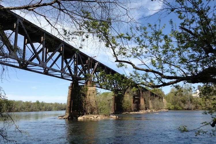
Photo: carolinathreadtrailmap.org
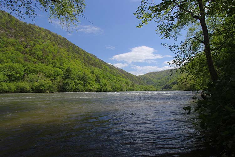
The Catawba River Blueway
Flowing from North Carolina into South Carolina, the Catawba River takes paddlers through scenic backcountry stretches of river, long stretches of open lakes, and past some must-visit destinations. There are several dams along the entire 200-mile river—which you will need a vehicle to portage—but there are also some extra long sections of pure paddling bliss.
The northernmost put-in on the Blueway is located at the Long Island Access area. If you’re up for an open water paddle, this 31-mile stretch of flatwater takes you across one of the largest lakes in the state. South of Lake Norman, the river meanders to Mountain Island Lake, a smaller lake and more relaxed flatwater paddle.
From Mountain Lake, continue south past the USNWC as the river opens up and you head into Lake Wylie. Here you bounce back and forth between state lines until you reach the south end of the lake and the last section of the Catawba Blueway.
The final 30-mile stretch through Upstate South Carolina features Class I rapids and multiple takeout points, allowing paddlers and tubers to float shorter distances.
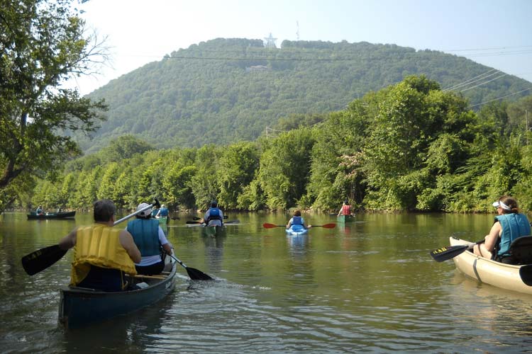
Photo: roanokeriverblueway.org
Roanoke River Blueway
Established in 2013, the Roanoke River Blueway passes through miles of backcountry and urban areas along its 45-mile journey to Smith Mountain Lake. Along the Blueway, there are 17 different access points, allowing paddlers and tubers to set up the float that is perfect for them.
While most sections of the river are easily navigable during a normal flow, there are several possible small portages that paddlers should be aware of and one major portage at the Niagra Dam. There is a fantastic brochure and map of this paddle trail with more detailed information over at roanokeriverblueway.org.
The Roanoke River Blueway’s location within the city limits provides a unique access to wildlife viewing, fishing, supplies, and refreshments along your journey downstream.
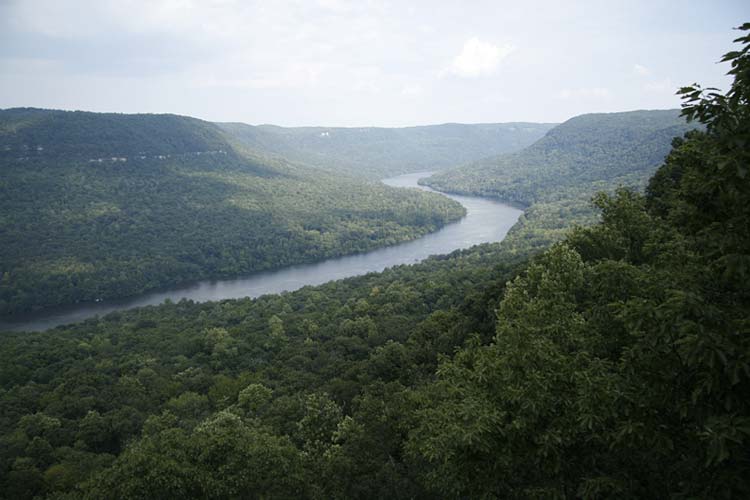
Photo: Blueway/Wikipedia
Tennessee River Gorge and Blueway
Designated as a National Scenic River Trail in 2002, the Tennessee River Blueway is a 46 mile paddle through Chattanooga and the Tennessee River Gorge. Starting at Chickamauga dam, this is one of the more unique paddling experiences in the region. Paddlers can stay in a downtown hotel and camp on public lands during the same trip.
As paddlers make their way through the 26-mile stretch of the Tennesse River Gorge, they are greeted by wildlife, rope swings, cliff jumping, and sandbars. This ancient stretch of river is surrounded by 27,000 acres of land, all protected by the Tennessee River Gorge Trust.
There are parts of the river that are used by barges and other boats, so paddle accordingly. There is handy map setup on Google Maps featuring boat launches, access points, rapids, and campsites.
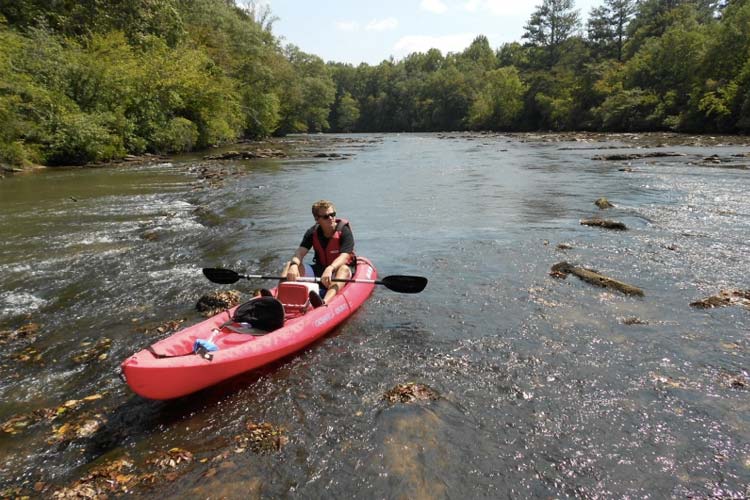
Photo: etowahwatertrail.org
Etowah River Water Trail
Spanning 163 miles from North Central to Northwest Georgia, the Etowah River Water Trail is a mostly flatwater paddle with a few sections of Class I-II rapids and one Class IV rapid. Along your paddle, you’ll encounter wildlife, rope swings, picturesque shoals, and Native American fish weirs. The headwaters of the trail are home to trout while Lake Allatoona is home to amazing largemouth and striper fishing—a dream paddle trip for fisherman.
Check out the interactive map for detailed locations of put-ins, portages, campsites, and more.
From local non-profit organizations and businesses to local governments and volunteers, this unique stretch of water is made possible by this group of stakeholders who work to maintain the quality of the trail and develop new access areas.
Play It Safe
Before heading out, remember that even the easiest stretches of river can become dangerous in high water. Always keep an eye on the forecast and monitor the river gauges. A simple Google search like “Catawba River Gauge” will give you several options to check both flows and height at various points along the river. Many rivers in the region are managed by power companies and have dam release schedules. Keep an eye on the schedule and plan your trip accordingly.
This should go without saying, but be sure to mind local laws and of course, wear a life jacket!
Whether you kayak, canoe, SUP, or Bellyak, get out and explore a Blueway this Summer. Is there a better place to paddle? We think not. Though, the region is home to our company, so we might be a little biased.